Eagle Rest Peak

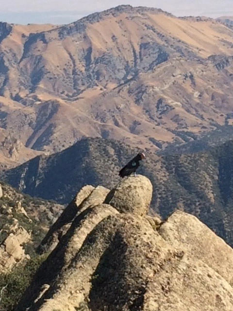
Eagle Rest Peak, Photo by Sunny Yi.

Peak Name

Eagle Rest Peak
04C

Elevation

6005

 feet

Status

active

Region

Southern Kern County West Of Hwy 5

Range

San Emigdio Mountains

Nearby peaks

Location

34.9074739,-119.1337189

Description

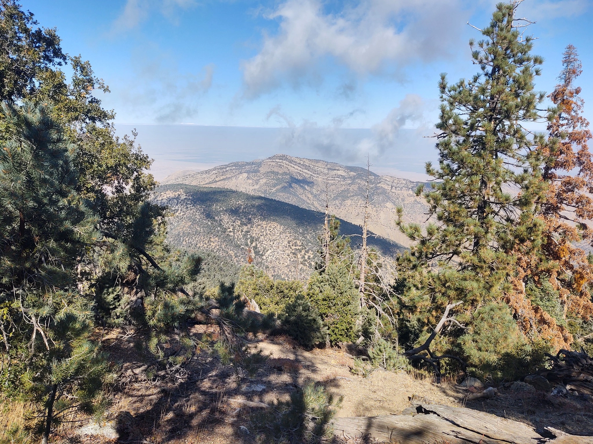
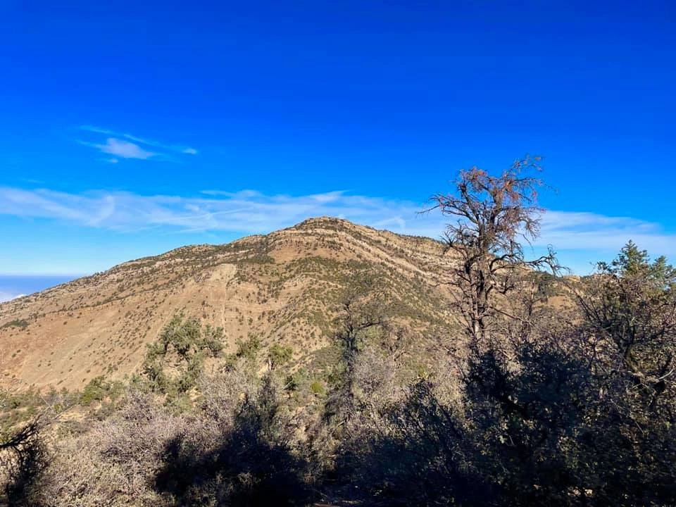
Eagle Rest Peak is in the San Emigdio Mountains within the Wind Wolves Preserve, one of many wilderness areas owned and managed by the Wildlands Conservancy. Eagle Rest is typically done as part of a two-peak, vigorous hike passing over Antimony Peak on the way. The views from the peak are spectacular; colorful geologic formations, green and pretty Cuddy Valley, Mount Pinos and other beautiful pine-forested peaks, and the San Joaquin Valley to the north. Although eagles are no longer seen here, condors sometimes are. Consider the heat carefully if hiking in the summer.

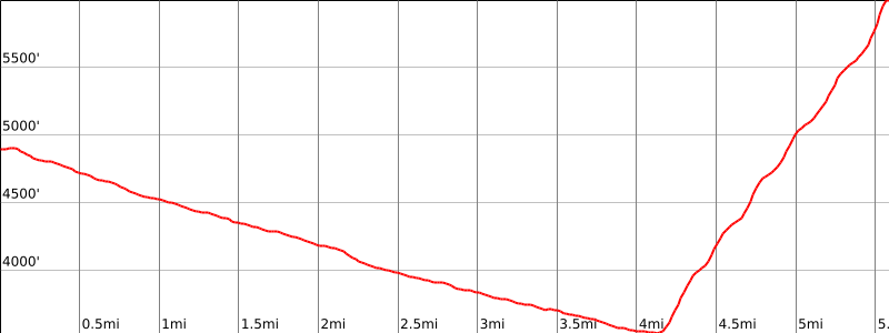
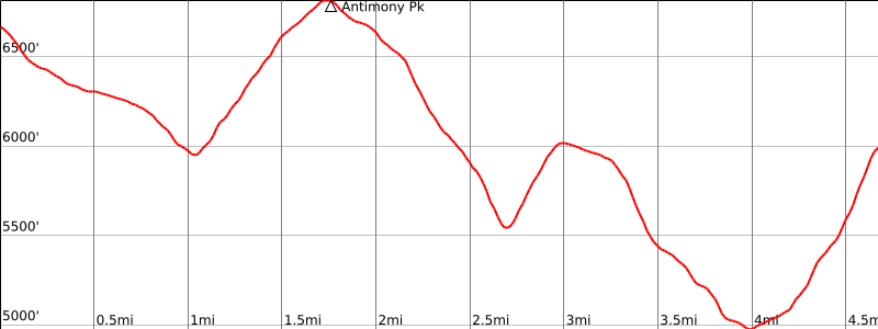
Eagle Rest Route 2 follows Antimony Route 1, which descends then climbs again to the summit on an old road once used to transport the antimony that was mined there. From there the trail descends, then over a bump and descending yet again for a final class 2 scramble to the summit, a total of 3 miles beyond Antimony. Consider stashing water along the way for your return. Prepare yourself mentally for 2900′ gain on your return in three tedious uphill sections. Route 1, much less often traveled, descends gradually down scenic San Emigdio Creek, crisscrossing across the creek multiple times on a vague use trail to a pretty meadow, before ascending steeply up a ridge 2500’ in less than 2 miles on somewhat slippery ground. Route 2 requires a high clearance vehicle, while Route 1 does not.

Maps generated from CalTopo.com, reproduced with permission

Route 1- San Emigdio Creek
Elevation Gain
3700′ total, 2300′ out plus 1400′ on return
Navigation Difficulty
Difficult
Distance
11 miles round trip on a poor road and cross-country
Estimated time
8 hours round trip
Route Rating
Class 2, strenuous
Leader Rating Required
“I”, normal conditions

Driving route

Go north on I-5 to the Frazier Park exit. Exit the freeway and turn left onto Frazier Mountain Park Road.
Go west 12.2 miles to the junction with Mil Potrero Road. (The road changes name to Cuddy Valley Road at 7 miles.) Turn right (left goes to Mt. Pinos).
Go west 4.5 miles to Nesthorn Way on the right (north). Turn right.
Drive about 500′ to the end of the paved cul-de-sac on Nesthorn Way.
Exit the cul-de-sac on the right side on a dirt road (unnamed) and continue about 500′ to a locked gate on the dirt road. Park here (4850′). Do not park on Nesthorn Way and do not block the locked gate. Permission is not required to hike down the road beyond the locked gate at this time.

Hiking route

From the parking area, hike down the road about 1.4 miles along the west fork of San Emigdio Creek, passing a sign “Wind Wolves Preserve”, to the junction with the east fork of San Emigdio Creek. The final portion of this road is washed out and should be bypassed on the left (northwest) slopes of the creek.
Turn left (north) down the main canyon of San Emigdio Creek and continue to follow the road, where possible, down canyon to a gate with a sign “Private Property – KCL Co”.
Pass the gate and follow the faint roadbed northerly down San Emigdio Creek. The roadbed is much overgrown and is washed out in many places. Where it disappears, stay on the right side of the streambed. Continue down the road for about 2.3 miles to where the canyon widens out into a sagebrush-dotted meadow (3520’+). Across this meadow a grassy ridge comes down from the northeast with a faint use trail going up it.
Follow the faint use trail up the ridge, eventually passing through a Pinyon pine grove (5500′) and then ascend the steep grassy slope north toward the sandstone cliffs. An occasionally ducked route leads up through the cliffs just above the trees.
The summit is reached immediately after ascending a ramp that passes the final large buttress on its right side.

Route Notes

Printable Route

Road Type

Paved

Google Maps Link to Trailhead 

Route 2- Via Antimony Peak
Elevation Gain
5300′ total, 2400′ out plus 2900′ on return (includes gain and loss over Antimony Peak)
Navigation Difficulty
Difficult
Distance
11 miles round trip on old road and cross-country through heavy brush
Estimated time
8 hours round trip
Route Rating
Class 2, strenuous
Leader Rating Required
“I”, normal conditions

Driving route

See the Antimony Peak guide.

Hiking route

From the summit of Antimony Peak, follow the north-northwest ridge keeping to the right of the small bump just west of the summit of Antimony. The route from this point onward can be extremely brushy.
Follow the ridge down to saddle 5520’+, then over major bump 6000’+, down to another saddle 5037′ and then north up the ridge to about 5400′.
From here go west to pick up Route 1 at about 5600′, which proceeds as follows:
An occasionally ducked route leads up through the cliffs. The summit is reached immediately after ascending a ramp that passes the final large buttress on its right side.

Route Notes

Printable Route

Road Type

None

Google Maps Link to Trailhead 

Additional Peak Information

Alternate route: Eagle Rest Peak and Antimony Peak can be combined into one hike by combining Route 1 for Antimony Peak with Route 1 and 2 for Eagle Rest Peak. The hike would go out to Antimony Peak via Antimony Route 1, continue to Eagle Rest Peak via Eagle Rest Route 2 and return to the vehicles via Eagle Rest Route 1. This will involve a car shuttle on 6 miles paved road and on 4.5 miles dirt road between the trailheads.

Nearby Peaks

Backus Peak
Owens Peak
Black Mountain #5
Morris Peak

External Links

mountain 1

Peakbagger.com

Click Here

ranger-tower 1

Nearest ranger station

Click Here

g311

NOAA Forecast

Click Here

worldwide 1

Google Earth

Click Here

Photo Gallery